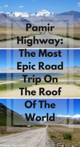
Pamir Highway: An Epic Road Trip from Dushanbe to Osh
Are you looking for an adventure of a lifetime?
Driving the Pamir Highway might be just the right kind of thrill for you.
The Pamir Highway (M-41) cuts through one of the highest mountains in the world. The Pamir Mountains have been called The Roof Of The World for centuries.
To be honest, a more accurate name would be The God’s Sandbox. Whichever power created these mountains, seems to be running experiments on what could survive in some of the harshest conditions on Earth.
The Pamir Highway can hardly be qualified as a highway in any modern country. Sure, it runs high, and it’s a way, but the narrow road with potholes, uneven or missing pavement, and even gravel and dirt sections is more suitable for off-road driving than high speeds.
Still, the magnificent, rugged, imposing peaks of the Pamir Mountains, hugging the road from all directions, make driving on this challenging surface an unforgettable, life-changing experience.
Follow our journey as we drive the Pamir Highway and take detours to explore one of the most remote and fascinating regions of the world.
The Journey: Which Direction Should You Choose?
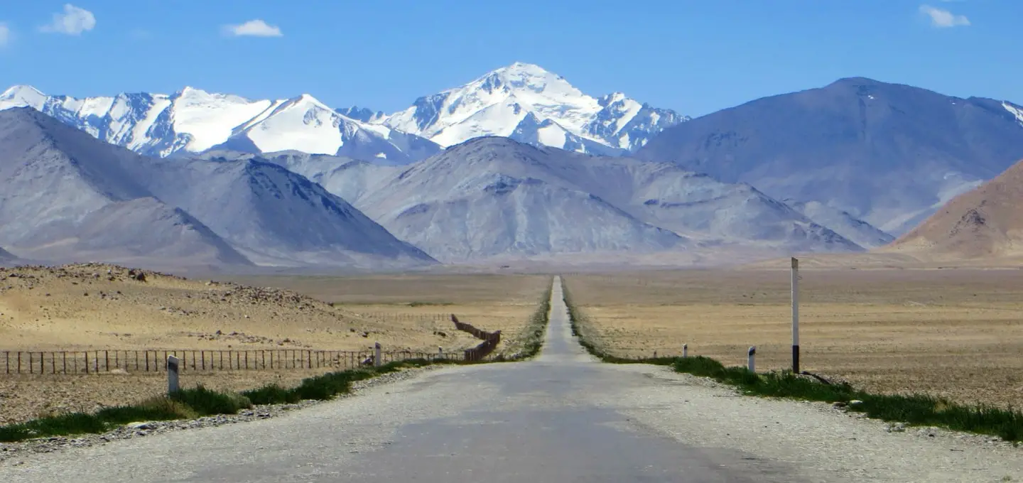
The Pamir Highway stretches from Dushanbe (the capital of Tajikistan) to Osh (the second-largest city of Kyrgyzstan). The most spectacular part of the road is between Khorog, Tajikistan, and Sary-Tash, Kyrgyzstan.
You can follow the Pamir Highway in either direction: start in Kyrgyzstan and finish in Tajikistan or vice versa.
The first version is more popular, but the latter is actually better to take.
And here’s why:
Altitude sickness.
Travelers who start driving the Pamir Highway in Kyrgyzstan, ascend too quickly and just after the border, at an elevation of 4,280 m (14,042 ft.), they start to feel the effects of altitude sickness.
The border at Kyzylart Pass is the second highest border crossing in the world and although the surroundings are stunningly beautiful, they hide a great danger for your health.
The best way to deal with altitude sickness is to quickly return to lower heights.
But there’s a problem:
If you cross the border and enter Tajikistan on a single entry visa, you can’t go back to a lower altitude in Kyrgyzstan. Your visa won’t be valid for a second entry in Tajikistan so you can either return and miss driving the Pamir Highway, or continue your journey in discomfort.
We met travelers in Karakul, the first Tajik settlement after the border, who had entered Tajikistan earlier that day and had excruciating headaches.
None of us had major health issues as we started our journey in the Tajik capital Dushanbe. We slowly ascended and our bodies got used to the high elevation.
The only symptoms of altitude sickness we experienced were shortness of breath and high heart rate. But these can be also easily attributed to dancing and hiking or to the magnificent views along the way!
Leaving Dushanbe: The Start of a Great Adventure
After leaving the capital of Tajikistan – Dushanbe – you’ll follow some excellent roads. Our tour guide Sherali tells us they were built by the Chinese.
The two governments made a deal. The Chinese would receive the right to exploit mines in the Tajik mountains, while the Tajik would get newly paved roads.
Tajikistan is the poorest of the ex-Soviet republics. Yet, the smallest –Stan country is extremely rich in minerals, gems, and ores. The problem is, they’re located in hardly accessible places.
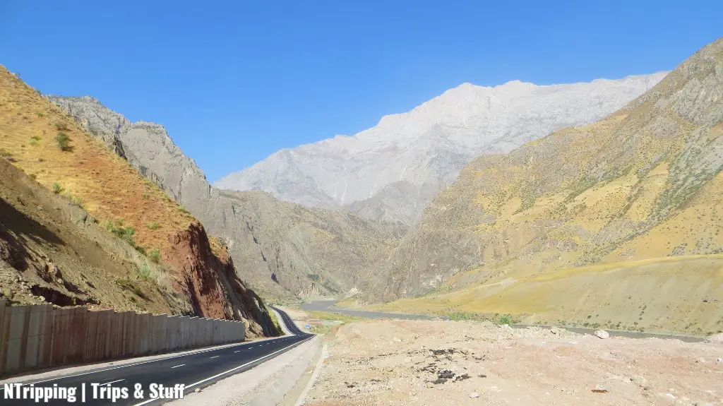
You’ll see the construction works going on while driving on the first day of the journey. Between Dushanbe and the Afghan border, the roads are in great condition – newly paved, wide, and well-marked.
Soon this will change.
After several hours of driving on the Chinese-built roads, we reach the Panj River. We would follow it for the next couple of days. On the other side of the river, we would see Afghanistan.
The higher you climb into the mountain, the smaller the settlements will become. Naturally, there aren’t so many people who would want to live in the harsh conditions of the Pamir Mountains.
In villages in the middle of nowhere, you’ll meet people, struggling with nature and the ignorance of all governments, past and present.
Kalaikhum: A Growing Town at The Banks of the Panj River
The first day of the tour features the longest drive. We don’t follow the Pamir Highway all the way as we make a detour to visit Kulob and its fortress.
The heat during the day is unbearable and the conditions in the homestay in Kalaikhum are basic. There are in fact hotels in town which we didn’t know about. So we sleep under a tin roof which emits heat the whole night, making the inside temperature quite unpleasant.
Still, after the tiring first day, full of magnificent views and interesting encounters, we fall asleep to the chatter of the hosts and the sound of the river flowing under our windows.
Khorog: Vibrant Town Life and the Last Chance to Check Your Emails Before Kyrgyzstan
In Khorog, we stay for two nights in a basic but comfortable hotel. The town is vibrant, laid back, and surrounded by majestic peaks. The Panj River flows right through the middle of it. A shaky suspension bridge hangs behind the hotel, connecting both sides of the river.
The botanical gardens atop a nearby hill are the second highest in the world and boast different plants indigenous to Asia and Europe. I find the views from up there even more beautiful than the blossoming flowers in the gardens.
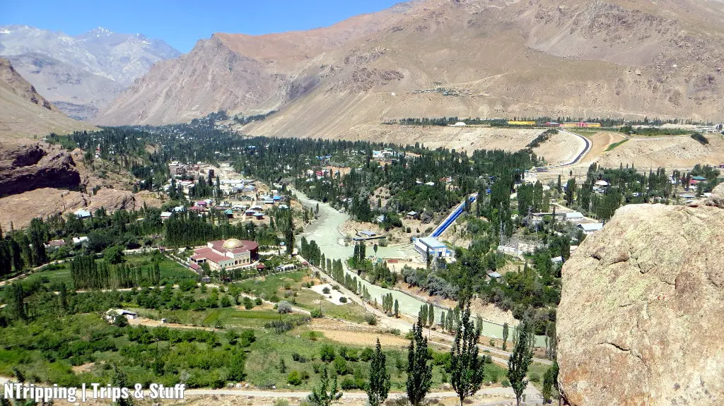
Next, we visit the town market. It is full of colors, aromas, and smiling faces. People stop to chat with us, tell us stories, and take pictures with us.
The choice of restaurants and food in Khorog is the best on the Tajik part of the Pamir Highway. You’ll want to stock snacks and dry fruits from the market, as well as some beers.
From Khorog, we leave the Pamir Highway for a while to follow the Wakhan Corridor. The views on this road are even more magnificent, everyone says.
Indeed, stop at the side of the road and watch the Panj River for a few moments. Tonnes of raging waters seem to be crashing the boulders right in front of your eyes. The rugged, rocky mountains on both sides are proof of their power.
The fast-flowing, wild waters are followed by slower, calmer waters, almost like the still surface of a lake. The scenery changes so fast that you don’t have time to photograph everything let alone put your camera away.
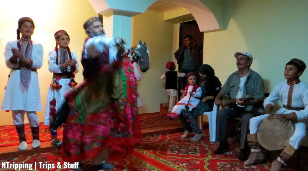
Yamg And Langar: Hot Springs, Traditional Dances, and Incredible Landscapes in the Wakhan Corridor
The homestays in Yamg (or Vrang) and Langar are built for travelers. The food is decent and the rooms are comfortable. There’s running water and we’re happy to shower after the dusty ride from Khorog.
We pass through several villages on the way and all of them appear to have hot mineral springs. We soak in two of them. The hot water makes the outside heat seem pleasant.
In Yamg, the host organizes a folklore concert for us. Children sing and dance and present Tajik traditions. The highlight, however, is the 86-year-old, half-blind man on his rug horse. We dance and laugh and have a great evening, making new friends and experiencing a new culture.
Near Yamg, you can visit the Yamchun Fortress and the museum of the famous Sufi, Muborak Kadam.
We spend the next night in Langar. Unfortunately, there’s no room in the homestay for all of us so the group needs to split.
That’s one of the things we quickly learn about traveling through the Pamirs: reservations don’t hold. Even if you have pre-arranged accommodation, if someone else arrives before you, he’ll get your room. It’s just the way things work here.
The evening in Langar is chilly. The wind starts blowing vigorously as the daylight disappears and gives us the first hint of what we should expect in the next few days.
Alichur: The Coldest Place in Tajikistan With the Warmest Hosts
After Langar, the road quickly ascends, away from the Wakhan Valley and up into the High Pamirs.
My head starts spinning not just from the high-rising peaks around us but also from all the turns of the road. I ask the driver to stop to get some fresh air. I splash my face with the cold, refreshing water of the stream, flowing almost vertically from the nearby mountaintop.
The others don’t mind the stops as the views are magnificent and every turn and peak is worthy of our admiration.
We reach the Hargush Pass at 4,344 m (14,252 ft) and soon drive again on the worn-out asphalt of the Pamir Highway, three days after we have left Khorog. Actually, we only cross the highway and get off the road to visit the nearby lakes.
We visit Tuz-Kul (the Salt Lake) and Yashikol (the Green Lake), located at around 4,000 m (13,123 ft) above sea level. We peek at Lake Bulunkul, where the lowest temperature in Tajikistan has been measured: -63°C (-81.4° F).
The village of Alichur is where we spent the next night. For the first time on our trip, there’s no running water, no electricity (except for a car battery to charge our devices), and no streets between the houses.
The next day we wake up to the singing of the Imam, calling for prayer. The temperature has dropped below 0° C in the night. The water in the streams, running through the village, has frozen.
And it’s August… But the elevation here is 3,865 m (12,680 ft) which explains the extreme amplitudes.
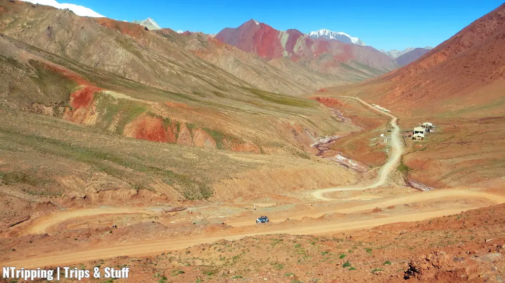
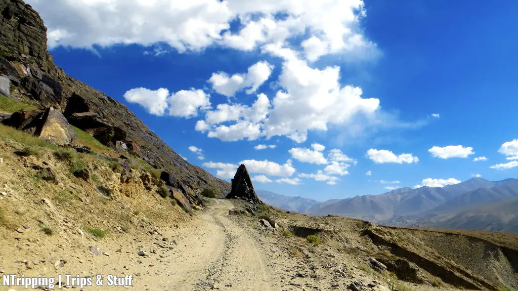
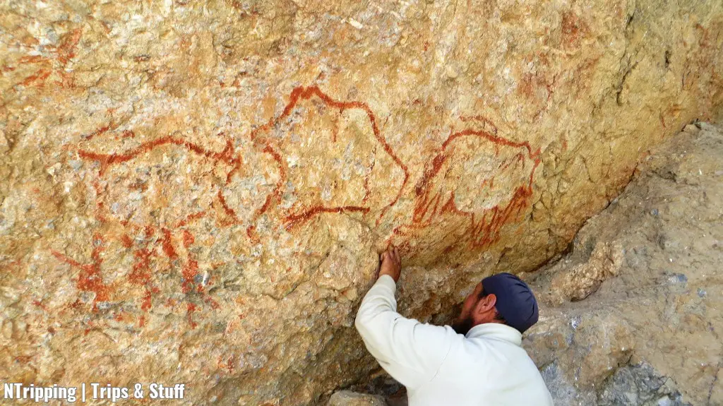
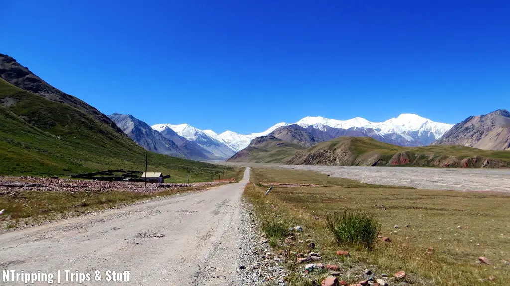
The High Pamirs: Pastures, Petroglyphs, Racing on Desert Roads, a Chinese Tomb, and a Fish Hospital
You’re now in the High Pamirs.
You can race on desert roads and climb to reach centuries-old petroglyphs at around 4,100 m.
There are green pastures, yaks staring at you, temporary yurt villages, and streams with crystal-clear waters. There’s even a fish hospital: a small pond where sick fish come to heal in the winter and then leave healthy in the spring.
We drive through a village to reach an old Chinese tomb.
Children are playing on the dusty road in front of their houses. They stop their game and start waving at the cars. We wave back, of course. A few meters away, elderly men are sitting in front of another house. We wave, they wave, we exchange smiles. Who needs electricity, television, or video games?!?
The Chinese tomb was built by travellers on the Silk Road. Unfortunately, we can’t go inside so we shoot a few photos and get back in the cars. The wind is freezing and we’re eager to continue driving.
Murghab: The Largest Town in the High Pamirs With a Predominantly Kyrgyz Population
Murghab is mostly famous for its market. Because of the burning sun and the strong wind, which blows dust from every direction, the stalls are placed in ship containers.
We spend two nights here in the only hotel in town. It’s good to have running water and electricity again, even just for a few hours a day. The food is decent (try the yak ribs!) but the rooms need getting used to.
Most windows are sealed and even with these precautions, the wind manages to blow a layer of dust inside. The air in the hotel is sticky and it’s hard to breathe. A stench follows you around, up the staircase, down the corridor, and into your room. But still, that’s the best we can get and we’re satisfied with it.
We’re lucky the Chabysh Festival takes place on the weekend we’re in town. The horse festival is something most of us have never seen before. The horse games reflect the nomadic way of life of the people of the High Pamirs.
We’re having tonnes of fun: dancing and chatting with the locals, meeting fellow travelers, and cheering for the local sports stars. The hours pass by unnoticed.
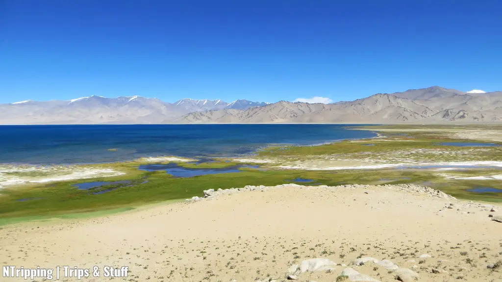
Karakul: The Last Settlement Before the Border at the Shores of the Salt Lake
Karakul, or the Black Lake as the name translates, is one of the largest salt lakes in Asia.
To be honest, I tasted the water and it wasn’t salty at all ;) But don’t just take my word for it, you should try it for yourself and let me know how you like it!
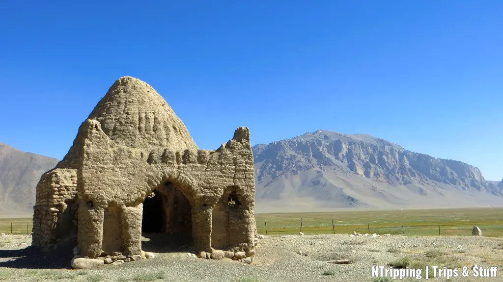
The road to Karakul takes you past a 19th–century Russian fort and through the highest point of the Pamir Highway.
Ak-Baital Pass, at 4,655 m (15,272 ft), is the highest elevation any of us has ever been before. The wind blows dust in your face and tries to tip you over. Nevertheless, we stop for photos and to admire the surrounding high-rising peaks.
The Pamir Highway is more of a dirt road at this point. Several motorbikes and cars drive by while we take in the views, and disappear in clouds of dust.
The road follows the no-mans land between the Tajik and the Chinese borders. Built by the Russians, the fence runs almost parallel to the Pamir Highway. At several locations, the wooden posts are missing.
“This is called the Russian Forest,” our guide informs us. “There’s no wood in the area and whenever the locals need material for their houses, they steal it from the fence.” Indeed, when we arrived at our accommodation, we discovered a post was used to support the gate.
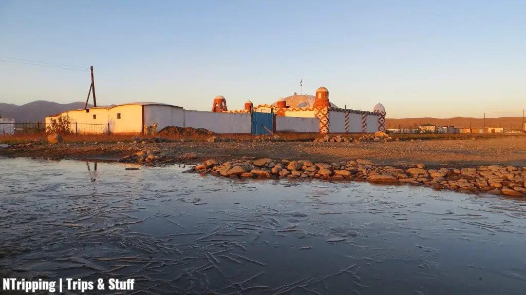
We occupy the only homestay in Karakul. Several other groups of travelers, as well as a few couples, also spend the night here.
We spend the next day and a half relaxing, exchanging stories with fellow travelers, and exploring the area around Karakul. Despite its name, the waters of the lake have the most staggering and unbelievable hues of blue. The highest peak in the area, Lenin Peak, rises in the distance. Its cap of never-melting snow shines in the sun.
The sunsets over the peaks at the shores of the lake are stunning. Unfortunately, the wind blows fiercely and forces us to go back inside before the mesmerizing light spectacle is over.
Leaving Tajikistan: Crossing the Second Highest Border in the World
Shortly after you leave Karakul, you’ll cross the border and exit Tajikistan.
Some of the highlights of the journey can be seen in the no-mans land between the borders of Tajikistan and Kyrgyzstan.
We make multiple stops in the approximately 25 km (15.5 mi) stretch of unclaimed land. The High Pamirs have kept the best for last.
The border crossing takes time despite the lack of other travelers. The officials chat with us. My basic Russian allows me to have a simple conversation with the Kyrgyz border official. When he learns I don’t have any children, he offers to give me one of his five. Maybe next time ;)
Once we enter Kyrgyzstan, everything suddenly changes.
The Pamir Highway starts to resemble a modern road. The pavement is no longer half-eaten by erosion and usage. The desert landscape and the 7-thousand-metre-high peaks pull back to make way for the green Alay Valley. The food at our first stop in Kyrgyzstan – Sary Tash – tastes a lot better than the meals we ate in Tajikistan.
But some things are the same as in Tajikistan.
The homestay in Sary Mogul, where we’re supposed to spend the night, is overbooked and there are not enough rooms for us. We drive around the village and eventually find the perfect accommodation. There’s running hot water and a shower, electricity, and even WiFi.
And just like that, we’re back in civilization. Everyone’s looking down at his phone or laptop. The conversations cease, and we enjoy a quiet evening catching up with news and emails.
Lenin Peak Base Camp: Our Final Goodbye to the Pamir Mountains
The Pamirs have one more magical place to show you before you return to the modern world.
Head to the yurt camp at the foot of the 7,134 m (23,406 ft) high Lenin Peak. On both sides of the bumpy road, velvet green hills roll, and yaks graze.
The yurt camp is on the shores of a small alpine lake. Its crystal clear waters reflect Lenin Peak’s snow top. The beauty of the scenery is indescribable and photos do it no justice.
This view beats camel racing in Dubai!”, exclaims Shane, The Travel Camel.
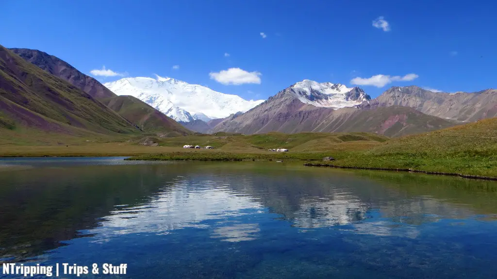
You’ll be speechless and breathless, much more from the majestic view in front of you rather than from the high altitude.
The lunch at the camp is scrumptious. We enjoy a few hours at the lakeside, taking in all the beauty around us. Then we have to leave. We take our goodbyes with the magnificent Pamir Mountains and head back to Sary Mogul.
Arriving In Osh: The End of Our Pamir Highway Adventure
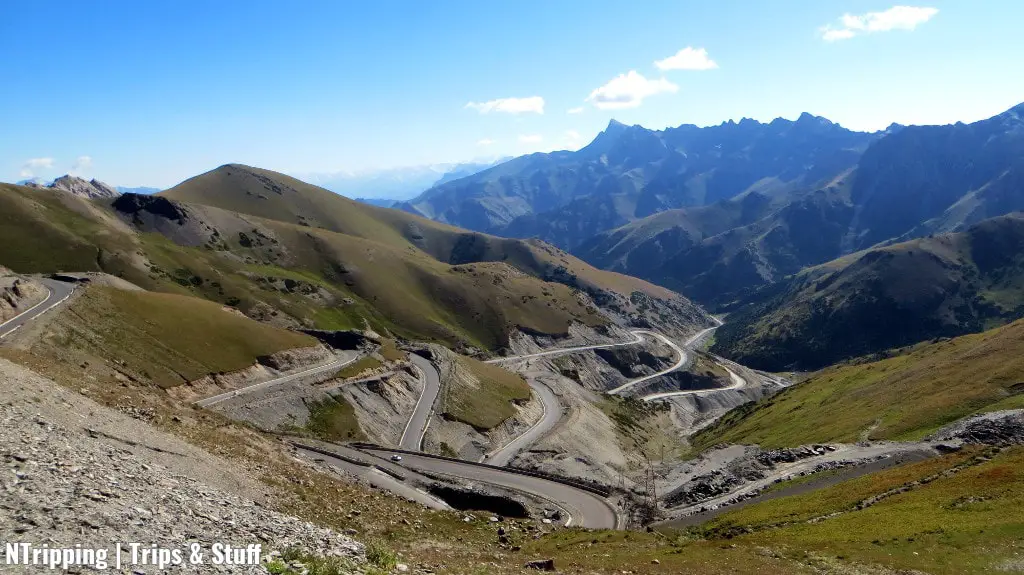
The next day we’re back on the Pamir Highway. The last stretch to Osh is perfectly maintained. It is evident that Kyrgyzstan is a wealthier country than neighboring Tajikistan.
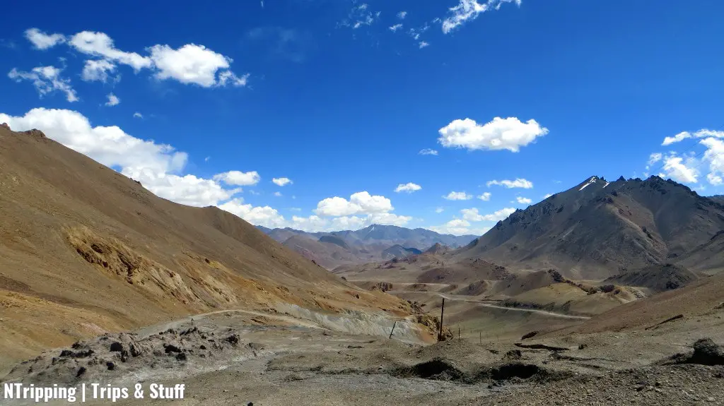
We’re no longer driving through the Pamirs but rather crossing the Alay Mountains. The road quickly ascends to 3,615 m (11,860 ft) at the Taldyk Pass. On the other side of the pass, it turns and twists like a serpent. The view leaves us in awe for the thousandth time.
From there on, we descend. Shortly afterward, we enter Osh, Kyrgyzstan’s second largest city after the capital Bishkek. The traffic thickens, the noise increases, and the temperature rises.
We’re back in the modern world.
These are our last few hours together, then everyone is off to their next destination.
I’m lucky to have booked an evening flight and get to spend a whole extra day in Osh. The weather is perfectly sunny and hot and the city is buzzing with the annual festival.
An important stop on the Silk Road, Osh is a melting pot of cultures and ethnicities from all over Central Asia and the Middle East. The festival represents the traditions of the people living in the 3,000-year-old city. It is colorful and vibrant, full of provoking smells and exotic rhythms.
The day is quickly over. I pack my bags and head to the airport. It’s been a fantastic two weeks full of new friendships, memorable encounters, fascinating views, incredible stories, and unbelievable challenges.
The Pamir Highway: A Road Trip Like No Other
For centuries, nomads have roamed the valleys and merchants have traversed the paths, following one of the Silk Road’s routes through the Pamir Mountains. Nowadays, adventurous souls seek to conquer one of the most impressive and epic road trips in the world.
If you’re seeking an unforgettable travel experience that will challenge you, test your skill, and transform you, driving the Pamir Highway is the right trip for you.
The quickly changing magnificent scenery, the hospitality and generosity of the people, the fascinating culture and traditions, and the overwhelmingly harsh conditions will make this journey one of the most rewarding in your life.
So tell me, are you ready for the most epic drive in the world, the Pamir Highway?
I am ready! I love the mountains, but this is taking it to another, much higher (yet exhilarating) level!
The Tajiks and Kyrgyz people look very similar to Bulgarians. I wonder why :P
Svet, you would love this road trip and the awe-inspiring views!
Indeed, the Tajiks are a lot like the Bulgarians. I won’t be surprised if our ancestors came from exactly this part of the world ;)
Cheers,
N.
When are you taking me there? Let’s hitchhike to make it even more thrilling! :-)
What are your travel plans for August? ;) I’ll be more than happy to drive the Pamir Highway again but hitchhiking is not really my travel style – too many uncertainties. But I’m sure we can come up with enough other thrills to make the ride even more challenging!
I’m all years! Let’s put the most thrills and ride the highway in August then :-)
How long do you imagine it would take, I mean the whole trip?
We did it in two weeks and the speed was fine.
I would change a few of the stops and add more activities like hiking and yak riding. I’d also suggest to extend the Kyrgyzstan part and continue from Osh to Bishkek overland, exploring this beautiful country as well.
Overall, 3 weeks sound perfect to me. I need to consult the local guide for all the details, of course.
This looks amazing, the way through those shady mountains looks deliberate.I haven’t thought that Tajikistan is that much beautiful.This the best road trip I have ever read about and this road trip has inspired me a lot.
Tajikistan is out-of-this-world beautiful! And the Pamirs are just a small part of the country’s treasures.
I’m glad you liked the post :) Happy travels!
Cheers,
N.
Tajikistan is extraordinary no doubt. And Pamir Highway is more than beautiful
Absolutely – couldn’t agree with you more!
Cheers and happy travels :)
Enjoyed your writing. I am looking at this trip for the 1st week in September. I have 10 or 11 day available. You mentioned that you’d change a few stops- what would you have changed? My plan is also to start from Dushanbe and end up in Osh.
Thanks
Gill
Hey Gill,
glad you liked the post! I envy you for heading to the Pamirs soon :)
We stayed for two days in Murghab. Imho, it is quite boring and not worth spending so much time there. We were lucky to experience the Chabysh Festival but without an event going on in town, there’s not much one can do. If I were to travel the Pamir Highway again, I would just stop in Murghab for lunch, spend about half an hour checking the market and stocking on snacks, then continue to Karakul.
In Karakul we also spent 2 nights, which was too much. (One of the days was a buffer day in case we got stuck somewhere due to bad weather and closed roads. ) So these are three nights already you can skip, making the duration of the trip exactly 10 nights – 11 days.
I would suggest reading my other two posts about the Pamir Mountains on the blog as there’s more practical advise in them. Also, I can highly recommend the guide we travelled with. He recently published his website, you can find it at “https://www.pamirsacreds.com/”. He’s available via email and WhatsApp but have in mind that internet in Tajikistan is poor so he might not reply immediately.
Let me know if you have any more questions – I’ll be happy to help you plan your trip :)
Cheers,
N.
Interesting info about Pamir highway, thanks for sharing, I would like to visit it :)
You definitely should, Rahul! The Pamirs are an incredible and fascinating place to see :)
The photo of Taldyck pass looks awesome. Nice itinerary.
Thank you, Talant! My photos couldn’t fully capture the beauty of the mountains but one at least gets an idea of how splendid the Pamirs look!
http://bnr.bg/ru/post/100183689/pamir-a-ne-sibira-v-poiskah-drevnih-kornei-protobolgar
Hi, just translate the text
YA
Hi YA,
thanks for sharing this! To be honest, that was exactly what I thought while travelling through the Pamirs :)
Cheers,
N.
Hi , Thank You for the write up. Very Informative .
“https://www.pamirsacreds.com/”. This link does not open somehow.
Thanks again
Hey Girish, thanks – glad you liked it :)
You’re right, the website isn’t available any longer. You can check https://pamirpersonaltours.com/ (run by the same awesome guide we traveled with).
Cheers and stay safe,
N.